


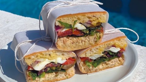
Chef Richard Knight's Pain Baigné
If you are looking for a spectacular sandwich to take on your picnic this summer, this is the sandwich for you. And the best part is that you can make it the night before and it will be even better.
...

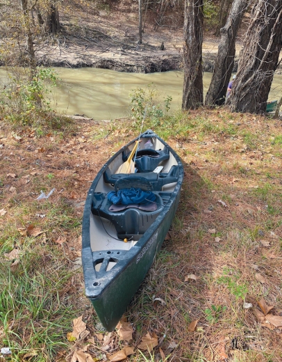
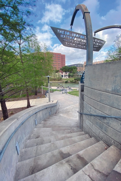
Houston’s iconic Buffalo Bayou runs for 53 miles from its source in Fort Bend County through the heart of the city to the Galveston Bay. Chef Richard Knight takes us for an “up close and personal” paddle as he trails Urban Harvest Market Manager Tyler Horn in a canoe down the bayou:
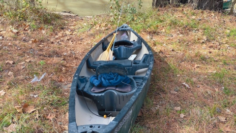
I bought a canoe a few years ago to discover the Buffalo Bayou from the water but haven’t been out in it much. I put in a few times near the Sabine promenade, a designated canoe launch spot near downtown. Even on these downtown paddles I saw beauty, flora and fauna I didn’t know existed locally. I also saw the ugliness of the dirty water and the trash strewn everywhere, even up in trees.
The last time I took it out was in the aftermath of Hurricane Harvey in 2017, to help people to safety as bayou water flooded into streets and homes. I hadn’t been out on the bayou since, which seems a little silly since I live literally five minutes from the Buffalo Bayou. It was high time to dust off the old canoe again.
I contacted an old friend, Tyler Horne, with the hopes of tagging along with him for a paddle. Tyler is Urban Harvest’s Director of Farmers Markets and an avid paddler who has been out on Buffalo Bayou at least 30 times over the years. We chatted long and hard about logistics, weather and water flow. Tyler agreed with me on the difficulty of getting in and out: “There are many city-designated launch sites along the paddling trail. Some are easy, like Memorial Mews, while others are extremely challenging, with a lack of steps and possibly a 30° incline that you have to drag your canoe up.” He gave an example: “Trying to get out at Briar Bend was definitely the worst experience I have had on Buffalo Bayou. There’s a big S-shaped bend right there and the bayou water runs extremely fast. That, paired with the launch site not being maintained at all, was a little scary.”
The term bayou is said to come from the Choctaw word bayuk, meaning “small stream.” It then evolved into Cajun French and eventually found its way into the American language. To most people the word suggests something quite different from the Buffalo Bayou, a more boggy, marshy and stagnant body of water more like you see in Mississippi and Louisiana. Houston has 10 waterways flowing through so quite rightly it is labeled “the Bayou City.”
There are various theories about the bayou’s name, the most likely coming from when Texas was occupied by the Spanish and the bayou was known as Río Cíbolo, or the Buffalo/Bison River. Sadly, the enormous herds that roamed the area were all hunted to extinction, with the last recorded herd passing through in 1836. Shortly thereafter, the Allen brothers founded the city of Houston right on the banks of Buffalo Bayou and it was the city’s main artery and lifeline for many years. Apparently there are Houston residents still alive today who recount stories of parts of it quite often running clear, affording swimmers a dip to cool off beneath the intense Texas sun.
For our expedition earlier this spring we put in near Terry Hershey Park at Memorial Mews, which Tyler had used before. This was a great spot as you could park next to the path and the embankment below was not too steep to take a canoe down. As Tyler had predicted, the water was running at a good pace towards downtown, where it would connect with White Oak Bayou, then down into the Houston Ship Channel and out to the Gulf of Mexico.
With Tyler and his father-in-law in one boat, myself in another, we took off. Once adrift we were promptly taken up by a swift current. Tyler informed me that because of recent rain the water was flowing pretty fast, at 1,600 cubic feet per second instead of the normal 200. We glided rapidly through the first stretch, taking in everything around us like explorers from another age navigating the river for the first time. We were suddenly cocooned in a green world as the bayou flowed through a wooded area, cut off from mankind’s continual hubbub. Our senses seemed heightened in this new peaceful world. The birdsongs became sweet and clear; the insects from the shore added a comforting droning rhythm and before you could even see them, we heard the splash of sunbathing turtles vanishing into the murky water like little aquatic Houdinis or perhaps just real Ninja turtles.
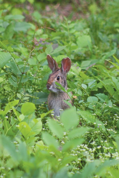
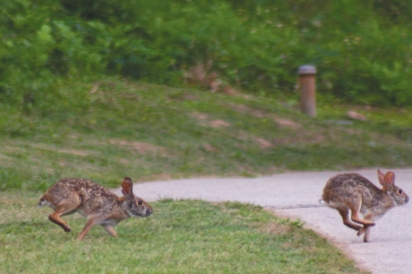
This first stretch through Terry Hershey Park was narrow with the greenery encircling us closely on all sides. It was wonderful to see the multitude of wildlife thriving here within the nation’s fourth-largest city. Herons and egrets were stealthily catching dinner on the shoreline; a hawk hovering above did the same with a mouse or two. We saw butterflies dancing their way from plant to plant and to our great surprise two otters jumped in the water just behind us as we passed.
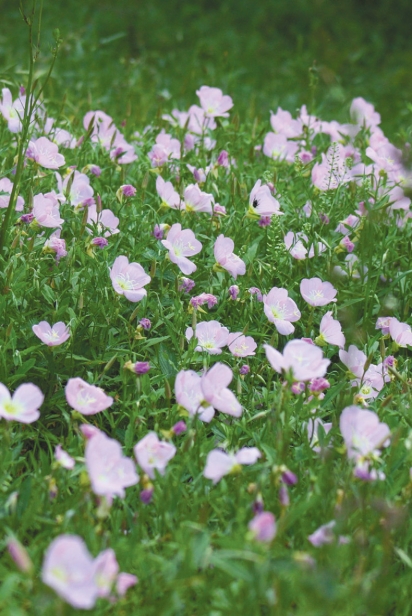
Wildflowers were in beautiful abundance, in so many shapes and colors, popping up all over the place in a wonderful random array. There are many varieties, most ever-changing through the seasons, everything from the vivacious ground cherry, bluebonnets and scarlet pimpernel to the more low-key Virginia pepperweed, wild onions and fleabane. The fish below us could be anything, the most common being channel and blue catfish and largemouth bass. And then there were the more unusual and infamous like the longnose gar, snapping turtles and, of course, from time to time the odd alligator.
We next found ourselves moving through a stretch that was a more residential area, with lots of expensive houses and a golf club bordering the water. The banks here were strewn with multiple varieties of so-called anti-erosion systems. There were giant boulders, broken concrete and rubble, chicken wire, plastic mesh and—the most common and most questionable—bags and bags of concrete, piled high like some war-zone bunker waiting for a waterborne invasion.
The closer we got to downtown, the more we saw pipes churning water and debris directly into the bayou. There were small plastic pipes from the residences on the banks, to giant corroded metal and concrete pipes leading from who knows where. Hurricane Harvey was an extremely unusual storm but really showed some of the soft underbelly of Houston’s stormwater systems. Buffalo Bayou and White Oak Bayou are designated storm channels to get rid of excess water but also they are used on a daily basis to pull off the rainwater from quite a lot of areas close by, which obviously includes downtown. Tyler explained that when it rains, basically everything (trash included) from the streets is washed down into the storm drains, which then flow underneath the city straight into Buffalo Bayou.
We had left one vehicle at a kayak launch near Post Oak and Woodway. We did have to negotiate a couple of tricky faster white-water areas and a few obstacles along the way and the last stretch was definitely a struggle as the bayou was wide and meandering. In all it was about 17 miles start to finish but we did not mind; by the end we were all very tired but happy. It was great to be on the water on such a beautiful day, canoeing through the core of Houston, drinking the odd beer, reciting pirate tales and genuinely enjoying nature.
Our Buffalo Bayou is a beauty, but she is turning into a beast with our neglect and failing stormwater systems. The bayou and the parks that surround her are an oasis in the city for people and wildlife. It is even better out on the water! I encourage you to take a paddle and go out and get to know her more intimately.
Copyright ©2024 Edible Houston. All rights reserved |Privacy Policy